A wind Radii of 13.9 m/s, 24.5 m/s, and 32.7 m/s forecast method for tropical cyclone in the Northwest Pacific Ocean and the south China sea based on subjective track intensity forecast and parametric wind field model (named as STI-RF-G) is developed. Here the improved CE wind field model by Shanghai Typhoon Institute, is chosen as the simplified wind model. Characteristics of key parameters including the radius of maximum wind and the Holland-B parameter are revised based on investigated for historical typhoons in the western North Pacific Ocean . Comparisons show that the wind field model has a high reliability in capturing the wind field characters within 250 km from the typhoon center. The detail of STI-RF-C is shown as follows:
Forecast region :Northwest Pacific Ocean and the south China sea;
Forecast time range :Yearly;
Forecast interval :120 h / 6 h;
Forecast times:Four times a day, including 02:00, 08:00, 14:00, 20:00 (BJT);
Operating conditions: Babj*.dat exists.
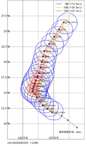
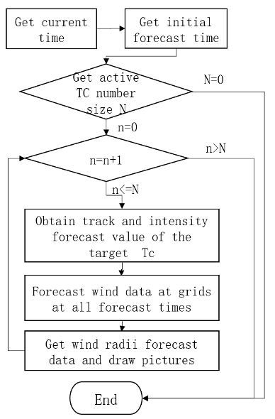
An sample of output is shown in fig 1. The process chart of STI-RF-G is shown in Fig.2.

Figure 1 An product’s sample of STI-RF-C for Malakas (2022)
(Initial forecast time: 2022041020 BJT)

Figure 2 The process chart of STI-RF-C