Typhoon Wind Radii Forecast using ClimatologyPersistence(TRF-CLIPER)
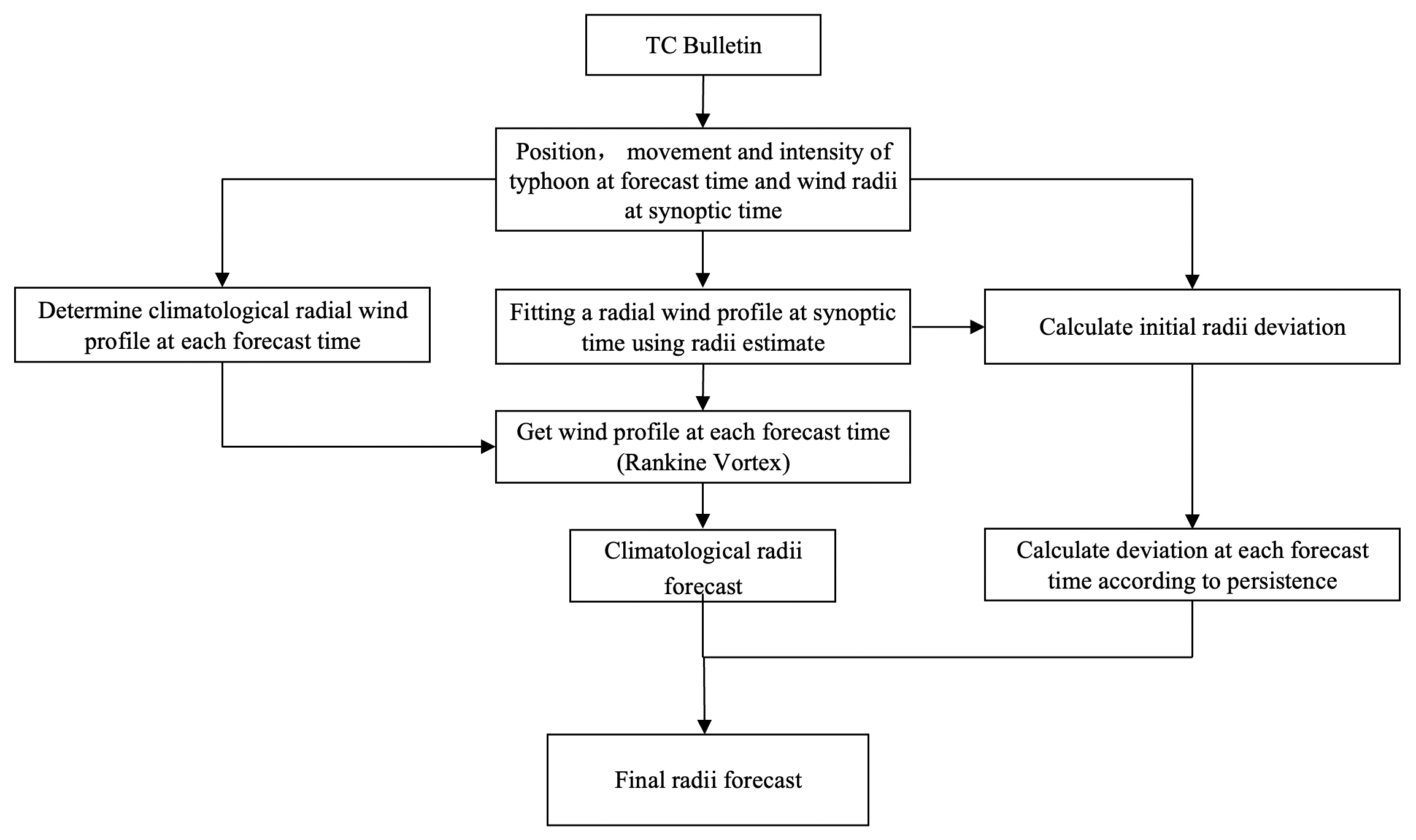
With a modified Rankine Vortex, the radial profiles of typhoon wind speed in different quadrants (ie. NE, SE, SW and NW) can be represented by a typhoon’s latitude, translation speed and maximum wind speed, which could be regarded as the climatological factors of typhoon’s wind radii. Fitting the Rankine Vortex equation by the historical typhoon data, a regression equation of climatology is obtained by which the wind radii can be resolved. Assuming that the forecast radial profiles approach the climatological ones gradually with forecast time, the climatological part of the wind radii of every forecast leading can be calculated by substituting the climatological parameters of typhoon into the equation. And there is a deviation between the estimated wind radii and the climatological part at the synoptic time. Consider the deviations decay exponentially over time, the radii deviation of each forecast leading time can be obtained. Finally, the forecasted deviations are added back to the climatological wind radii of each forecast time to obtain the final wind radii forecast.
Typhoon Wind Radii Forecast using ClimatologyPersistence(TRF-CLIPER)

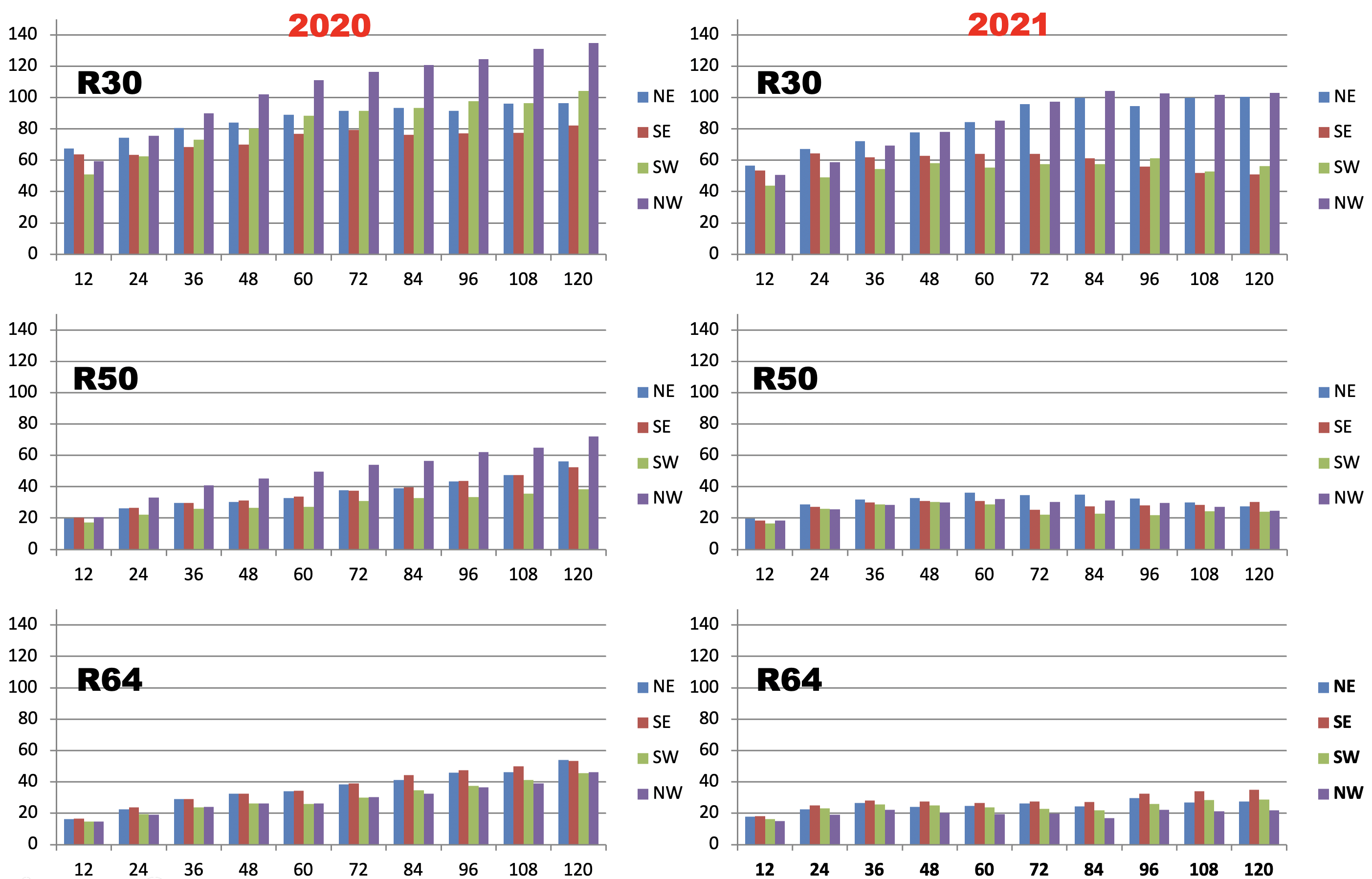
TRF-CLIPER Forecast Error for Wind Radii in 2020-2021

Typhoon Wind Radii Forecast using NumericalWeatherPredictionModel (TRF-NWPM)
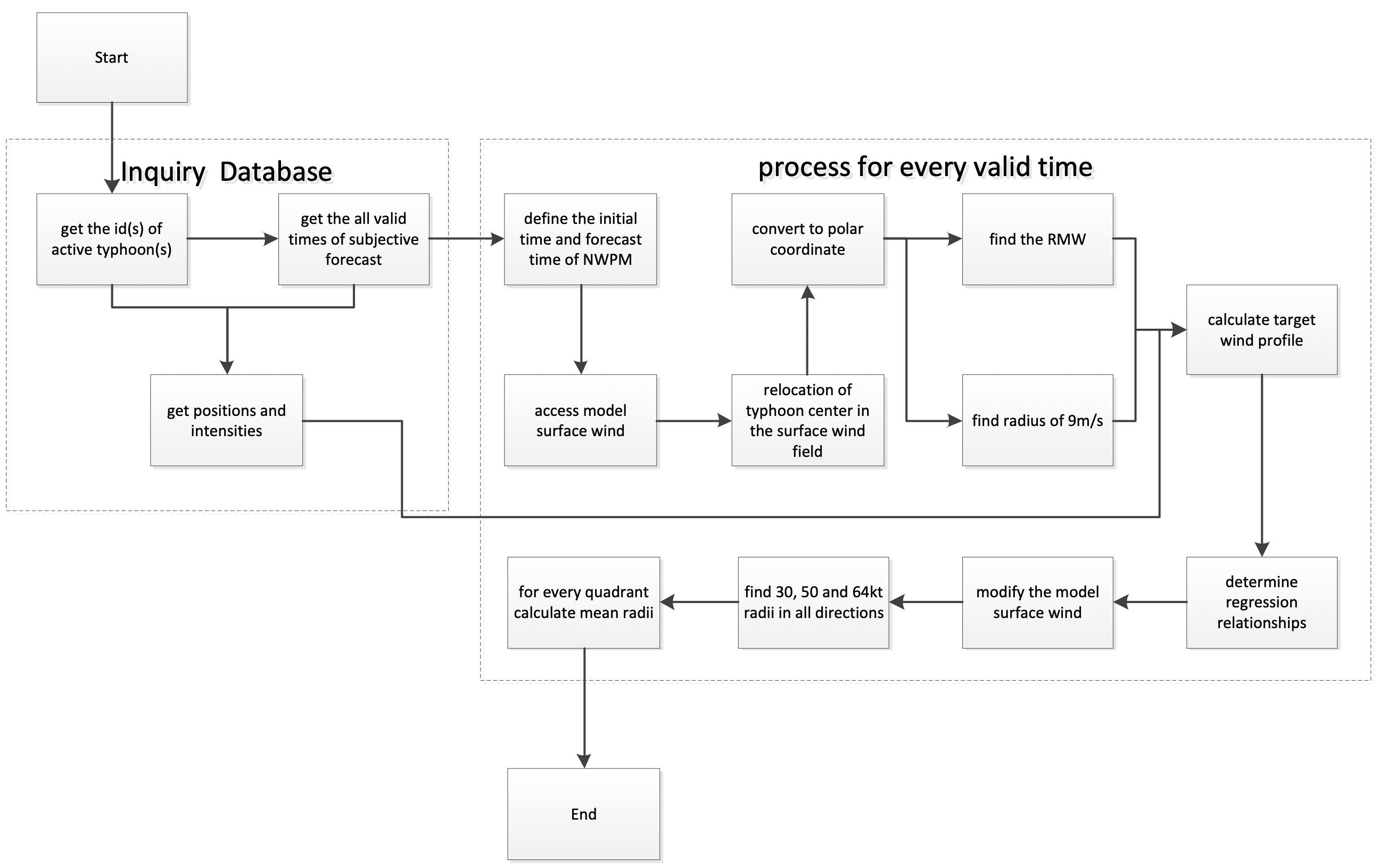
The main idea of this method is to adjust the surface wind (10 meters above ground) from numerical weather prediction model (NWPM) according to subjective intensity forecast. While keeping the wind structure resolved by the model, the forecasted intensity predicted is consistent with the subjective forecast.
The detailed scheme is as follows: firstly, the model surface wind is converted into a polar coordinate centered at the typhoon center, so that the maximum surface wind speed near the center of the typhoon can be located. The corresponding radius will be used as the radius of maximum wind (RMW) of the typhoon, and the wind profile in this direction is defined as the prototype profile. Secondly, a target wind speed profile is established using the model RMW, subjectively predicted typhoon maximum wind speed, a wind speed of 9m/s and it’s corresponding radius at prototype profile direction. Thirdly, for different radii from typhoon center, a series of regression relationships between the prototype profile and the target profile are established separately, and then applied to all the other directions of the NWPM surface wind to generate a modified surface wind field. Finally, the wind radii of 30, 50 and 64 knot wind speed in the four quadrants (northeast, southeast, southwest and northwest) can be find in the modified surface wind field.
Typhoon Wind Radii Forecast using NumericalWeatherPredictionModel (TRF-NWPM)
