A wind Radii of 13.9 m/s, 24.5 m/s, and 32.7 m/s forecast method for tropical cyclone in the Northwest Pacific Ocean and the south China sea based on subjective track intensity forecast and parametric wind field model (named as STI-RF-G) is developed. Here the Georgiou wind field model, which can reflect the equilibrium equation of the tropical cyclone vortex kinematics, is chosen as the simplified wind model. The detail of the method is shown as follows:
Forecast region :Northwest Pacific Ocean and the south China sea;
Forecast time range :Yearly;
Forecast interval :120 h / 6 h;
Forecast times:Four times a day, including 02:00, 08:00, 14:00, 20:00 (BJT);
Operating conditions: Babj*.dat exists.
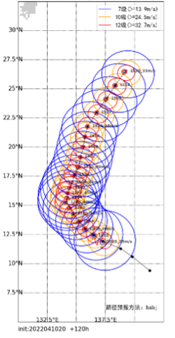
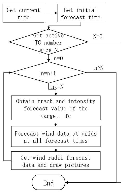
An sample of output is shown in fig 1. The process chart of STI-RF-G is shown in Fig.2.

Figure 1 An product’s sample of STI-RF-G for Malakas (2022)
(Initial forecast time: 2022041020 BJT)

Figure 2 The process chart of STI-RF-G